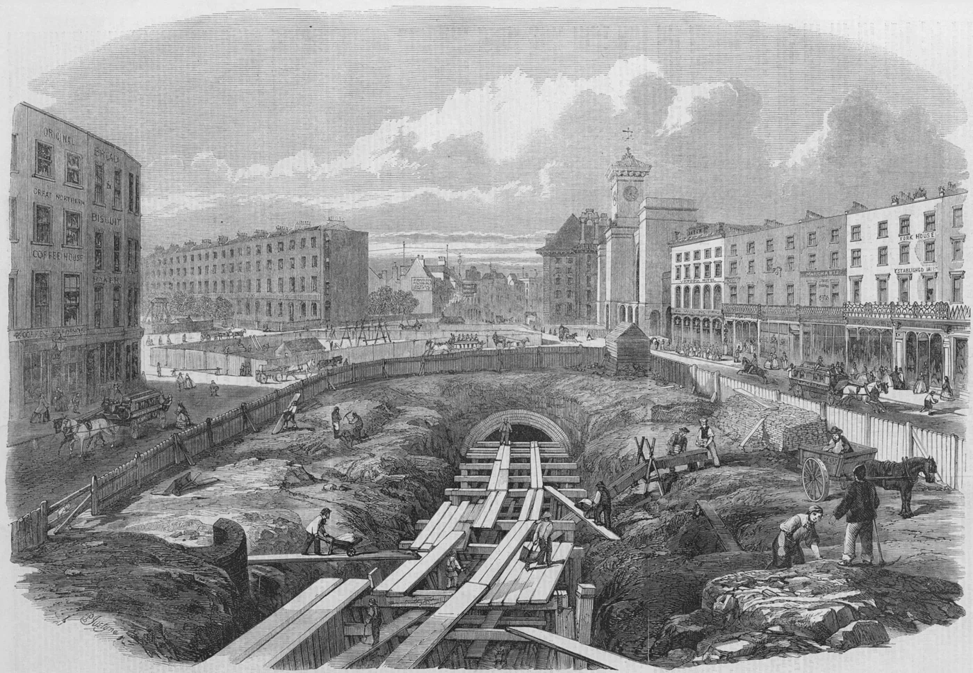
The Metropolitan Railway opened to the public in January 1863. London Transport Museum identifies it as the world’s first underground railway and describes how much of the construction used cut and cover.
The name is a useful summary of the method: a trench was excavated, railway infrastructure was built within it and the surface was covered again. It was not the same process as boring a circular tunnel deep below the ground. The distinction helps explain why underground routes do not all have the same appearance or depth.
One network, different engineering histories
London Museum’s history distinguishes the early cut-and-cover lines from the later deep tube railway. As methods and requirements changed, different parts of the system took shape in different ways. The modern map brings them together, but it can conceal those construction histories.
A line on that map is an aid to navigation rather than a cross-section through the city. To understand the engineering, look for the method, depth and relationship with the streets and buildings above. A familiar journey can contain several different layers of infrastructure history.
Read a transport story with two maps
A geographical map helps show where a route runs; a historical account explains why and how it was built. Together they ask better questions than either alone. When an illustration depicts construction, check which project and period it represents. A dramatic image of deep tunnelling should not automatically stand in for the work that created the earliest underground railway.
Follow the sources
Reference material consulted for this explainer. External publishers are not affiliated with or endorsing Factlore.
- London Transport Museum — When did the first underground railway open? ↗
- London Museum — London Underground: a quick history in pictures ↗
Source material consulted 14 November 2026.
A question to take away
Which details of a familiar station make more sense once you know how it was built?